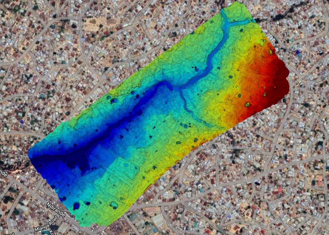
DSM/DTM/DEM Generation
LiDAR uses laser pulses to create high-resolution 3D maps of the ground and structures.
Surveying with a drone offers enormous potential to our GIS professionals and Drone Pilots. With our sophisticated drones, it is possible for Nkhwaziaeros to carry out topographic surveys of the same quality as the highly accurate measurements collected by traditional methods, but in a fraction of the time. This substantially reduces the cost of a site survey and the workload of specialists in the field. Nkhwaziaeros generates Orthomosaic Maps, Digital Terrain Model (DTM), and Digital surface model (DTS) created from aerial images taken by our fixed-wing drones and DJI Phantom drones.
LiDAR uses laser pulses to create high-resolution 3D maps of the ground and structures.
Drones generate orthomosaic maps and contour lines to represent terrain elevation.
Drones capture aerial data to create detailed 2D maps and 3D terrain models.